Charles Nisbet Campus

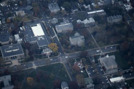
Aerial view of campus, c.1955

Aerial view of campus, looking over the Charles Nisbet Campus and the John Dickinson Campus around 1955. Morgan Hall is the building under construction on the left side of the photo.

Aerial view of campus, c.1965

Aerial view of campus, looking over the Charles Nisbet Campus around 1965.

Aerial view of campus, 1973

Aerial view of campus, looking over the Charles Nisbet Campus in November 1973.

Aerial view of campus, 1980

Aerial view of campus looking southeast over the Charles Nisbet and Benjamin Rush Campuses in February 1980.

Aerial view of campus, 1980

Aerial view of campus, looking northward over the Charles Nisbet Campus in February 1980.

Aerial view of campus, 1981

Aerial view of campus and the surrounding Carlisle community in July 1981.

Aerial view of campus, 1989

Aerial view of campus, looking south over the Quads toward South Mountain in December 1989.

Aerial view of campus, 1989

Aerial view of campus and Carlisle, looking northeast over Biddle Field in December 1989.

Aerial view of campus, 1989

Aerial view of campus and Carlisle, looking northwest over the Benjamin Rush and Charles Nisbet Campuses toward North Mountain in December 1989.

Aerial view of campus, 1993

Aerial view of campus around the intersections of College and Louther Streets and College and High Streets, in November 1993.

Aerial View of Dickinson Campus, 1980

An aerial view of the Dickinson College campus in September 1980 during the Kline Center's opening reception.

Aerial View of Dickinson Campus, 1981

Aerial view of Dickinson Campus and surrounding area in 1981.

Charles Nisbet Campus covered in snow, 2003

View of the Charles Nisbet Campus sign on W. High Street after a winter storm on February 17, 2003.

Plaza outside the HUB, c.1970

View of the plaza outside the HUB, dating from around 1970. The Spahr Library is visible on the right side of the photograph.

Subscribe to Charles Nisbet Campus