Maps and Diagrams

    Entries drawn from collection & document descriptions

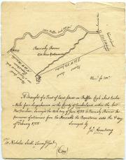
Survey map, June 1755 (Box 1, folder 10)
1755-1783

The collection contains papers related to John Armstrong's service as a surveyor in Cumberland County between 1755 and 1783. These papers include correspondence with the Surveyor-General of Pennsylvania and Delaware, John Lukens, complaints from his clients, and several survey maps drawn by...

Collection Inventory: PDF icon mc2001.04.pdf

Receipt for taxes, 1816 (Box 1, folder 9)
1792-1870

The collection includes business letters and legal papers of the Burd family, early deeds and patents, settlement of the Edward Shippen Burd estate 1848-1870, and correspondence concerning bequests for St. Stephen's Church, Philadelphia, the Burd memorial there, and the "Burd Orphan Asylum."

Collection Inventory: PDF icon mc1999.10.pdf

Contract estimate, 1849 (Box 2, folder 6)
1833-1854

This collection consists of drafts, letters, manuscripts, notes, financial accounts, and a prospectus for the publication of a book. Specifically, there are lectures and notes on mechanics, as well as drafts for patents on inventions submitted to the Royal Commissioners of the Great Exhibition...

Collection Inventory: PDF icon mc1999.08.pdf

Time Book, 1910 (Box 1, folder 7)
1906-1955

George Dum (c.1863-1918) served as secretary and treasurer for the Perry County-based Oak Grove Lumber Company. This collection contains materials pertaining to his interest in this venture, as well as his family's legal dealings with the associated Oak Grove and Kennedy's Valley timber tracts...

Collection Inventory: PDF icon mc2008.01.pdf

Maps and Atlases Collection
1839-1873, 1900

These images were taken from just a few of the maps and atlases housed in the Dickinson College Archives and Special Collections.

The sources include:

Thomas T. Smiley's Smiley’s Atlas for the Use of Schools and Families… (1839) 
S. Augustus Mitchell's New...

Location: Special Collections - Oversized

Subject: Carlisle and Cumberland County, Travel and Tourism

Format: Maps and Diagrams

Time Period: 1820-1839, 1840-1859, 1860-1879, 1900-1919

Autograph album, 1853 (Box 3, folder 04)
1853-1918

The collection consists of genealogical, financial, and scrapbook materials related to the McClintock and Wakeman families. Four ledgers concern research notes on George Washington. Also included in the collection are correspondence related to the Proeschel family. Julius N. Proeschel was...

Collection Inventory: PDF icon mc1999.12.pdf

Watercolor, undated (Box 1, folder 8)
c.1955-1984

This collection is composed largely of artifacts which the Millers brought back from their nine year mission to Nepal, 1956-1965. Also included in the collection are a scrapbook, picture books of Nepal, and a Nepalese hymnal.

Collection Inventory: PDF icon mc1999.03.pdf

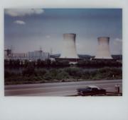
Photograph, 1979 (Photographs, folder 1)
1978-1986

The John H. Murdoch collection consists of various papers, newspaper clippings, audiotapes, and photographs collected by Murdoch during his involvement with Three Mile Island Alert. John Murdoch was a long-time resident of Lower Allen Township, Cumberland County and became involved in emergency...

Collection Inventory: PDF icon TMI-Murdoch.pdf

Envelope and postcard, 1983 (Box 2, folder 23)
1833-1994

This collection includes articles, manuscripts, newspaper clippings, and programs about Joseph Priestley and related topics. Also included in the collection are genealogical materials - correspondence, notes, charts - collected by Priestley family members

Collection Inventory: PDF icon mc2003.08.pdf

Copybook, c.1847-1851 (Box 1, folder 7)
1832-1861

The William Charles Ford Reed Collection was donated to the college in 1951 by the sons of William C. F. Reed, Class of 1851. The collection contains some of Reed's student writings, notebooks, and his complete set of school books. A subsequent donation in 1956 consisted of a few papers and 37...

Collection Inventory: PDF icon mc2001.16.pdf

Passport, 1925 (Box 3, folder 13)
1882-1958

James Gordon Steese (1882-1958) was a member of the Dickinson College class of 1902. Among his many activities, Steese served as president of the Board of Road Commissioners for Alaska; the Steese Highway in Alaska is named for him. He later was involved with the development of railroads in both...

Collection Inventory: PDF icon mc2002.04.pdf

Sermon, 1877 (Box 1, folder 17)
1837-1890

The collection contains papers of Ferdinand de Wilton Ward (1812-1891) concerning the Central Church in Geneseo, New York, the American Bible Society, and the genealogy of the Ward family. Also in the collection are a journal of Ward's voyage to India in 1837 and a letter book of the Indian...

Collection Inventory: PDF icon mc2000.06.pdf

Map, undated (Box 1, folder 7)
1797-1841

This collection is comprised of letters written to Isaac Wayne, Dickinson College Class of 1792 and Pennsylvania statesman, on various subjects ranging from biographical information on his father (General Anthony Wayne) to Wayne's service in Congress. Also included are a few letters written by...

Collection Inventory: PDF icon mc2001.11.pdf

Map of Land in Lycoming County, Pennsylvania
February 10, 1797

A map of lands in Lycoming County, Pennsylvania that is owned by James Campbell, Benjamin Rush, and Jacob Rush. Henry Donnel created this copy of the map.

Location: I-SpahrB-1957-11

Subject: Land and Real Estate

Format: Maps and Diagrams

Time Period: 1780-1799

Two Sketches of West College by Benjamin Latrobe
May 18, 1803

Architect Benjamin Henry Latrobe creates these two sketches as part of his proposal for the new academic building at Dickinson College. Latrobe's two sketches are for the north front and the basement of West College.

Location: RG 1/1 - 5.4.2

Subject: Dickinson College Administration, Education

Format: Maps and Diagrams

Time Period: 1800-1819

John Wilson Family Genealogy
1835 - circa 1950

This file contains information related to John Wilson's family genealogy. Dr. Wilson (1768-1835) is a member of the Class of 1792. Besides an obituary for Wilson by a Dr. John Lilly, there are also two family descendants charts. The first chart is originally from June 1850 and the second one is...

Engraving of the Public Square in Carlisle
1838

A hand-colored engraving of the Public Square in Carlisle in 1838. The caption reads: "As seen on entering from the east. On the left are the Court House, Town Hall, and Methodist Church, on the main street. On the right, in the foreground, is St. John's Episcopal Church, and on the other corner...

Location: I-Original-1838-1

Subject: Carlisle and Cumberland County

Format: Engravings and Illustrations, Maps and Diagrams

Time Period: 1820-1839

Subscribe to Maps and Diagrams